Lulworth Ranges
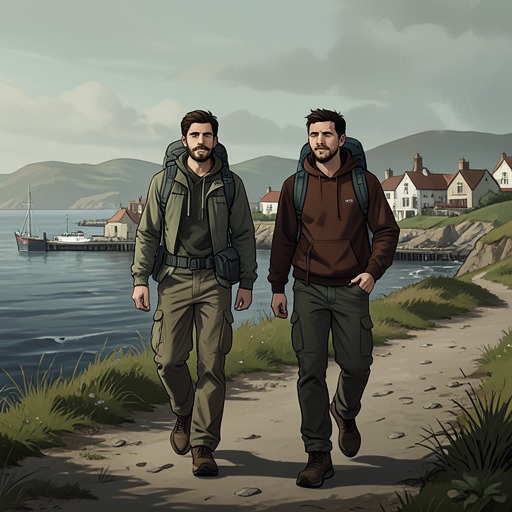
The Salt PathLulworth Ranges is a military training area stretching west towards Lulworth, where coastal access and wild camping meet the restrictions of an active military landscape. For Ray and Moth, crossing it meant weighing the risk of being discovered against the need to find somewhere to sleep. The ranges also hold a more complicated history: military control displaced the people of Tyneham, while the same limits on public access and intensive farming helped wildlife and vegetation thrive.
Military Landscape and Access
The boundary announced itself abruptly. A promising hillside gave way to a nodding oil pump and a six-metre-high razor-wire fence marking the start of Lulworth Ranges. A large sign prohibited camping, fires, drinking, running, photographs and unnecessary breathing; the path was open that weekend, but the area’s military character remained unmistakable. The ranges ran west for miles towards Lulworth.
The walkers faced an immediate choice. Turning back meant risking being moved on from the car park; going forward meant trying to reach Tyneham Cap before dark, hide their tent and hope not to be shot. Moth had sat in the car park long enough for his muscles to stiffen, making a long onward walk difficult. They passed through the bolted gate and camped halfway up the hill, out of sight of the village, intending to leave early before soldiers could discover them.
A Night on Tyneham Cap
The night brought the threat of discovery vividly into the tent. Ray woke to clicking and wheezing sounds that seemed to move from around the tent towards the cliff. Holding her breath, she expected the flaps to be pulled open and soldiers’ boots to appear outside. Nothing of the kind happened: the noise faded, while Moth slept on in his new sleeping bag.
At daybreak they left before anyone could know they had camped there. On the ridge of Tyneham Cap they encountered Dave and Julie, who had spent the night nearby. Dave told them that about twenty deer had gathered around their tent before moving into scrub on the cliff. What Ray had heard in the dark had not been a military patrol but wildlife; the morning account transformed a night of imagined danger into an encounter with animals moving freely through the range.
Tyneham and the Ranges’ History
After leaving Dave and Julie, Ray and Moth followed the path down to Worbarrow Tout and past Tyneham village. The army requisitioned the village in 1943. Although it did not return the land, having placed a compulsory purchase order on the properties after the war, the villagers remained displaced, their homes and memories caught up in the military use of the area.
The landscape bears an unsettling contrast: the military’s appropriation of a lived-in village and the resulting loss of home exist alongside an ecological consequence that the villagers’ departure did not intend. Limited public access, the absence of intensive farming and occasional small-arms fire allowed wildlife and vegetation to flourish across the ranges. The account describes this as a form of khaki conservation, an unexpected outcome of a place governed for military purposes.
Place in the Journey
For Ray and Moth, the ranges were neither simply wilderness nor simply a forbidden zone. The open path offered passage, while the fence, prohibitions and possibility of military discovery constrained where they could stop. Their decision to camp out of sight, and to leave early, made the practical conditions of travelling without secure accommodation part of their experience of the place.
The deer encounter sharpens that tension. The same scrub that seemed to conceal a possible patrol sheltered animals instead, while the wider history of Tyneham connected present-day movement through the landscape to an earlier displacement. Lulworth Ranges thus appears as a place where access, authority, refuge and ecological change overlap, rather than as an empty stretch of coast.